Continued from the blog post Carpacker 2015 – East Coast – #2 Journey Begins, Temerloh and Sudirman’s Grave. For pre-travel, please refer here.
We didn’t have time to go around Temerloh city, let alone it was still morning (about 8.30 am) and many shops had not opened. The traffic is not congested, it is calm to live in areas like this that are far from big cities like Kuala Lumpur. I just missed taking a picture with the billboard “TEMERLOH” which is quite popular and located on the banks of the Pahang River.
“It feels really comfortable this morning air in Temerloh… .. surrpppp, I inhaled the air contentedly… ..”
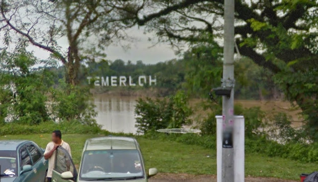
That’s the “TEMERLOH” billboard I mean.
OK. Had to cancel the desire to find a restaurant that serves Temerloh patin fish (also known as catfish in some countries). This morning, no restaurant is open. So we continued our journey to Jerantut via the old Temerloh-Jerantut road. I prefer the old road or better known as the state road or the federal road. A variety of attraction can be seen along the way and can stop in small towns that may be rare for some people. Save money because you don’t have to enter the LPT highway.
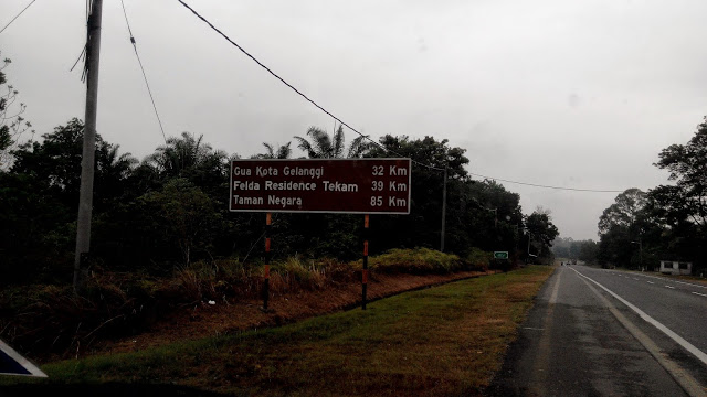
The journey to Jerantut takes almost an hour with a distance of 60 km from Temerloh. On the way and through the junction to Gua Kota Gelanggi, I had time to look at the signboard while saying in my heart… “Hey, when am I able to visit this famous Gua Kota Gelanggi?” There is a mysterious story about this cave. It is said that the cave has 7 levels. What is visible to the naked eye is only 6 floors. The last level is invisible. Very interesting, right? Hmmm, maybe we’ll visit it in another time.
The GPS location that I set on Google Maps is “Pulau Tawar, Jerantut”. Somehow, in a few kilometers towards the town of Jerantut, there is a junction to the right towards Pulau Tawar. I went in too. Hmmm, why is the road so narrow? Eh, this is a village road! If you look at the map, there is the main road to get there. This is the problem when using GPS. It will try to take you into the village alleys as long as the journey is considered a “shortcut”. Supposedly, we plan to visit his tomb first and then explore the city of Jerantut.
Our plan has changed.
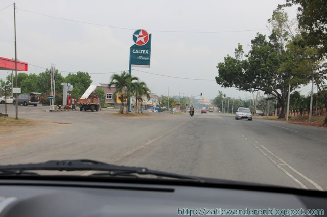
I felt that it can’t be like this…. So, I stopped my car and asked someone at the grocery store. When you ask the first person, his style is like a dumb person. He pointed a finger and told me to ask the man at the checkout counter. It feels like being kicked here and there like a ball. The man at the counter said that the place was located near Jerantut town. Had to turn back and continue the journey to Jerantut town via the main road earlier. This time I didn’t set any GPS and followed the direction he gave me earlier.
As soon as I arrived in Jerantut town, I saw a junction to “Kampung Mat Kilau”. Well, that’s probably his village and not his tomb. I thought maybe his tomb is nearby as well. Based on the directions given, he said Mat Kilau’s tomb was located on the side of the road. We keep looking … looking … and looking ??? Suddenly I realized. This road is heading to Kuala Lipis. Ah, we were wrong again. If we continue, we can continue to the city of Kuala Lipis and stop at the village of Siti Nurhaliza (to our non-Malaysian readers, Siti Nurhaliza is the top singer in Malaysia).
We turned back to the town of Jerantut. We are almost 8 km away from the city. I think, maybe the person who gave the instructions thought that we meant “Kampung Mat Kilau” and not “Makam Mat Kilau”.
But, when writing this blog post and reviewing the map, Mat Kilau’s tomb is actually located on the right side of the Pahang River. From the location that I entered by mistake and was asking for direction from a groceries store earlier, it meant that we have to cross the Pahang River. It appears on the map that there is no bridge to cross. Meaning, luckily we headed straight to Jerantut town.
But it’s okay. On our return back to the town, we stopped at a park with a very beautiful landscape next to an elementary school. It is also close to the junction leading to “Kampung Mat Kilau”. After all, the city of Jerantut can be explored in various ways and we are actually here for the first time.
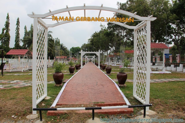
This is the place. Isn’t this garden beautiful? It is called “Taman Gerbang Warisan”.
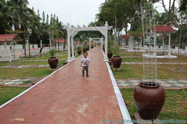
The landscape is very attractive. There is also plenty of seating to relax and enjoy the surroundings.
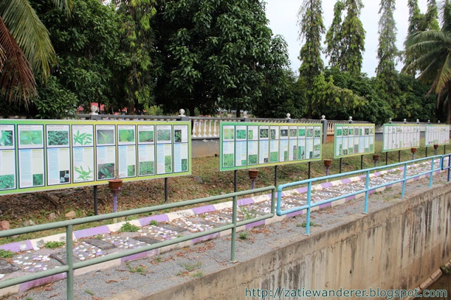
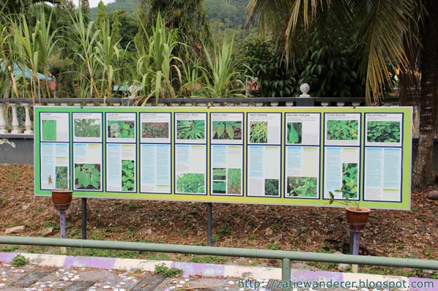
At the edge of the park, signboards are describing local trees and herbs that are nutritious for medicine and health.
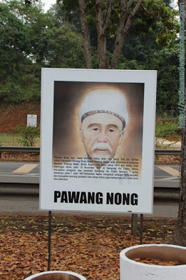
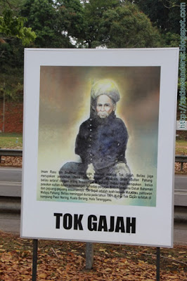
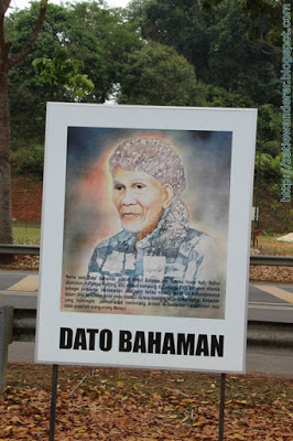
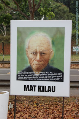
Haa… This is what I like about this park. It is good that the Pahang state government always commemorates the services of the old figures of Pahang. Here are pictures and brief information about the figures of Mat Kilau, Tok Gajah, Dato Bahaman and Pawang Nong.
Next, we took a brief tour of Jerantut town. I also tried to enter the road called “Kampung Mat Kilau”. My eyes searched for anything interesting, but nothing. So, I turned back to the main road and continued my journey to find the tomb of Mat Kilau. The distance from Taman Gerbang Warisan is approximately 22 km and takes 24 minutes. We arrived at a mosque on Pulau Tawar. Up to here, I’m kind of lost because there are many intersections or village roads. Nearby there is a grocery store and I even asked them. He said it is necessary to enter the village road and continue to go deeper.
We continued our journey from the mosque to the tomb. The map above is the GPS coordinates for use by readers of this blog or copy and paste “3.881344, 102.420342” into Google Maps. It looks like the Pahang River which is so wide is located near the tomb area which is less than 250 meters away.
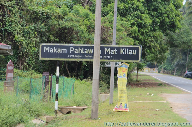
About 5 km from the mosque, there is a large signboard “Makam Pahlawan Mat Kilau” by the side of the road. Lucky for this tomb because the signboard was donated by Petronas Kerteh.
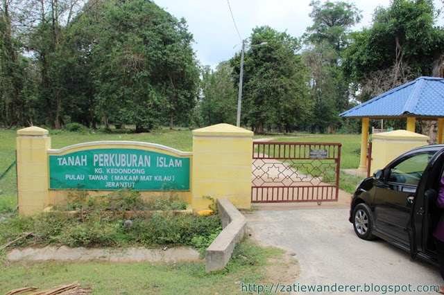
This is the entrance to the Kampung Kedondong Islamic Cemetery, Pulau Tawar, Jerantut, Pahang. It can be said that this area seems to be reserved only for the Mat Kilau Tomb because there are very few other graves there.
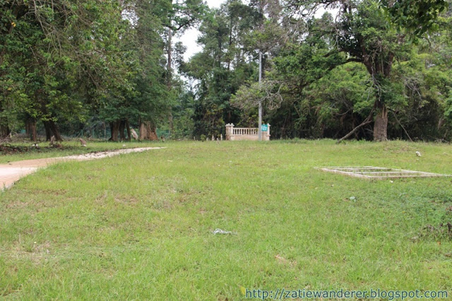
I even parked the car in front of the gate as no one goes in or out. The tomb is visible from afar. We stepped inside.
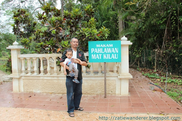
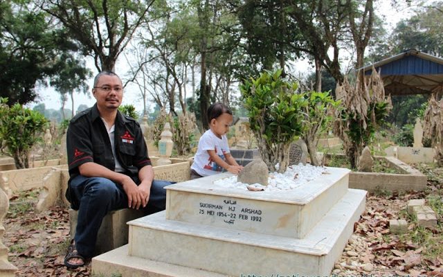
We’re here! This is the Tomb of Mat Kilau, one of Pahang’s leading warriors against the British. It’s been a long time my wishes to visit this place. His tomb appears to be filled with a handful of dry mudflats likely from the massive floods that hit the east coast last December 2014. After all, Sungai Pahang is so close to this area.
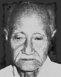
Who is Mat Kilau? His full name is Mat Kilau bin Imam Rasu (his father is known to the community as Tok Gajah). He was born in 1865 in Kampung Kedondong and died on 10 August 1970 at the age of 105 years. Mat Kilau’s mother is Teh Mahda, the daughter of Tok Kaut, Burau. When he was about 20 years old, Mat Kilau married a girl named Yang Chik Binti Imam Daud who came from the same village. As a result of this marriage, Mat Kilau was blessed with three children.
After getting married, he began to learn martial arts and study mysticism as well as the ability to use a dagger and machete. With his inner knowledge, Mat Kilau gained a lot of warrior knowledge so that he was able to disappear. His father Tok Gajah was also his martial arts teacher while Haji Osman (also known as Haji Muntuk) was his religious teacher. Haji Muntuk then moved to Pekan to become the Pahang State Mufti.
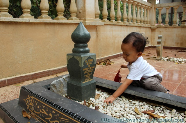
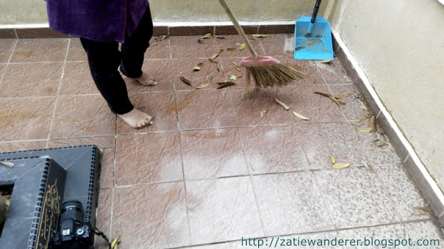
Coincidentally there was a broom by the side of the tomb. Tatie also helped clean the tomb area which was full of dust from silt or clay soils that had dried before we left for Kuantan.
Because I was chasing time to go to Kuantan and then to Kuala Terengganu, I had to cancel the desire to visit the Pulau Tawar Mosque which is evidence of the place where Mat Kilau had announced the appearance of himself who had been hiding for so long.
Articles about the mosque can be found at https://hazis.wordpress.com/sejarah-negeri-pahang/perjuangan-mat-kilau/.
Your presence is not raised, you go not to be remembered by people. It is not a name that is sought but your service and sacrifice remain eternal in praise. Sending a prayer for Malay fighter Mat Kilau bin Imam Rasu.
After visiting the Mat Kilau Tomb, we moved back to the mosque we passed earlier. Tatie plans to bathe Aqif and change his dirty clothes due to the dry mud. The mud there is quite thick. The clock shows 11.30 am. To wait for Zohor’s time is still a long time, so we continue our journey to Kuantan.
How much does it cost to Jerantut (follow current expenses, except food/drink)?
- Car fuel is still 3/4.
- Toll – None.
Continued in the next article ……… Carpacker 2015 – East Coast – #4 Kuantan City and “Independent Soul” Restaurant.

Leave a Reply